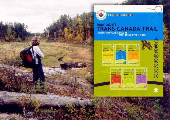
Individual guides for the six regions allow for economical updating of the ever evolving route. To purchase a guide contact geomapmanitoba.com or mrta.mb.ca.
Gold Award of Excellence, Interpretation Canada, 2005
“Attractive, easy to use, consistent design… Lots of great info.”
“Excellent. As a hiker/backpacker I would appreciate this product.”
“I like the links to GPS coordinates, great idea for a self-guiding experience.”
Judges, Interpretation Canada
Review by Trails Canada
“One of the best guides to the Trans Canada Trail yet to be produced… ”
Michael Haynes, Trails Canada
A series of six guides were developed for the 1,300-kilometre trail across the province. Each guide highlights that region’s landscapes, birding hotspots, architecture, history, local heroes, plants and animals and things to do along the trail.
Theme: The Trans Canada Trail introduces you to a diversity of landscapes, cultures and habitats across Manitoba.
Special Features: In addition to the six trail guides, six regional trailhead signs were developed and 65 interpretive nodes with a total of 195 interpretive signs.
To see more about this multi-phased project go to Planning.