Loading...
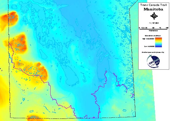
The trail, in purple, crosses a variety of landscapes.
The Trans Canada Trail Interpretive Plan was a multi-phase plan that spanned several years. Some components of the plan are completed while others are still being implemented today and can continue into the future as monies become available.
As lead consultant S. Dangerfield Interpretive Planning provided project management, working with a variety of partners to develop different components of the plan.
Phase I included:
- User profile and needs assessment
- Natural and cultural resource inventory by region, including consultation with local trail associations
- Inventory maps
- Description outlining 16 interpretive options with associated costs
- Recommended interpretive strategy – focusing on three key options
- Interpretive themes (8 themes corresponding to the 8 natural regions) and sub-themes by region (76 sub-themes)
The extensive research and consultation produced the 150-page report.
Phase II & III of the project included:
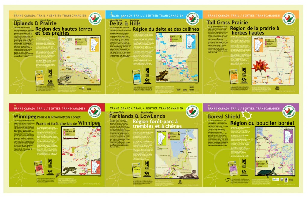
- Development of the six regional interpretive guides with interpretation on one side and a map of the trail on the other, these trail guides are the primary interpretive product
- Development of six regional trailhead signs; with a suggested 96 locations across the province prepared in consultation with local trail associations and registered with GPS coordinates
- Identification of 65 interpretive node locations across the province, each node located by GPS coordinates, each node to have several interpretive signs for a total of 195 signs
- Research and write text for interpretive signs
- Seven kiosk locations were recommended for key entry points to the trail that include interpretive signs, trailhead signs, outdoor exhibits and staging area
For a review of the guides see Awards & Reviews.
-
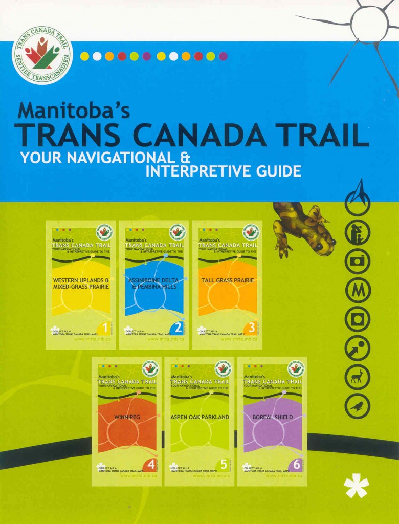
- The 6 TCT Interpretive Maps for Manitoba won a Gold Award of Excellence from Interpretation Canada

-
- TCT Trailhead signs mark the entrance to each of the six sections of the trail across Manitoba
